Biken und Wandern in Afghanistan
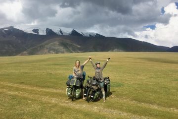
Nachdem ich im Herbst 2016 in Pakistan unterwegs war, wollte ich unbedingt auch Afghanistan bereisen. Obwohl große Teile des Landes viel zu gefährlich sind, um zu reisen, gibt es immer noch einige Gebiete, die für Ausländer genug sicher sind, wie der Wakhan-Korridor im äußersten Nordosten des Landes. Grete und ich beschlossen, einen Monat lang in diesem Teil Afghanistans zu biken und zu hiken (dt. wandern).
Sorry, dieser Beitrag wurde von mir noch nicht auf Deutsch übersetzt und ist deshalb nur in Englisch verfügbar. Eine Spende von dir würde es mir jedoch ermöglichen, unterwegs eine Auszeit in einem Guesthouse zu nehmen um weiter an der Übersetzung und Vervollständigung meiner Website zu arbeiten. Falls Englisch deine Muttersprache ist oder du sonst gute Englischkenntnisse hast, dann kannst du mich auch unterstützen, indem du Texte meiner Website übersetzt. Schreibe bei Interesse bitte eine E-Mail an info@marcmichel.ch.
In the Tajik town of Khorugh, we applied for an Afghan tourist visa and we prepared for our adventure. We bought provisions for 4 weeks and packed the food and all the equipment that we needed to bike and hike in Afghanistan. The rest of our gear we could leave at our guesthouse.
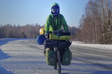
On Monday 9th July, we crossed from the Tajik town of Khorugh to the Afghan town of Shughnan. The border crossing was fairly easy, although it was surprising that we had to submit our fingerprints on the Tajik side, especially as we didn’t need to submit our fingerprints when we entered Tajikistan from Kyrgyzstan. Moreover, it was weird when the border guards in Tajikistan asked for our “Registration Card”, as you don’t get such a card when you enter from Kyrgyzstan on the Kyzyl-Art Pass. Luckily, it was no problem when we told the guards that tourists don’t get these registration cards when entering from Kyrgyzstan or Uzbekistan.
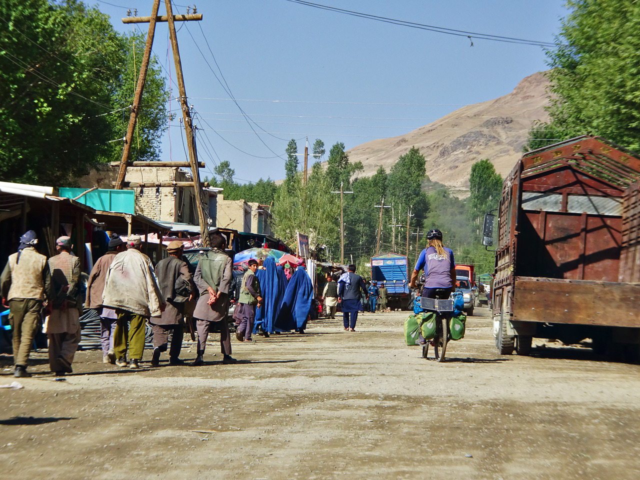
The first leg of our project was to cycle one hundred kilometres from Shughnan to Ishkashim. Due to the bad road condition and our heavily loaded bicycles, it took us three days to reach Ishkashim. When we arrived in Afghanistan, we asked ourselves if we were supposed to cycle on the right-hand side or the left-hand side of the road. Although Pakistan is the only neighbouring country of Afghanistan where cars drive on the left-hand side, I expected that it would be the same in Afghanistan. We could see some cars on the road, but half of them had the steering wheel on the left side and the other half hat it on the right-hand side. As there was not a lot of traffic, we simply cycled wherever we wanted.
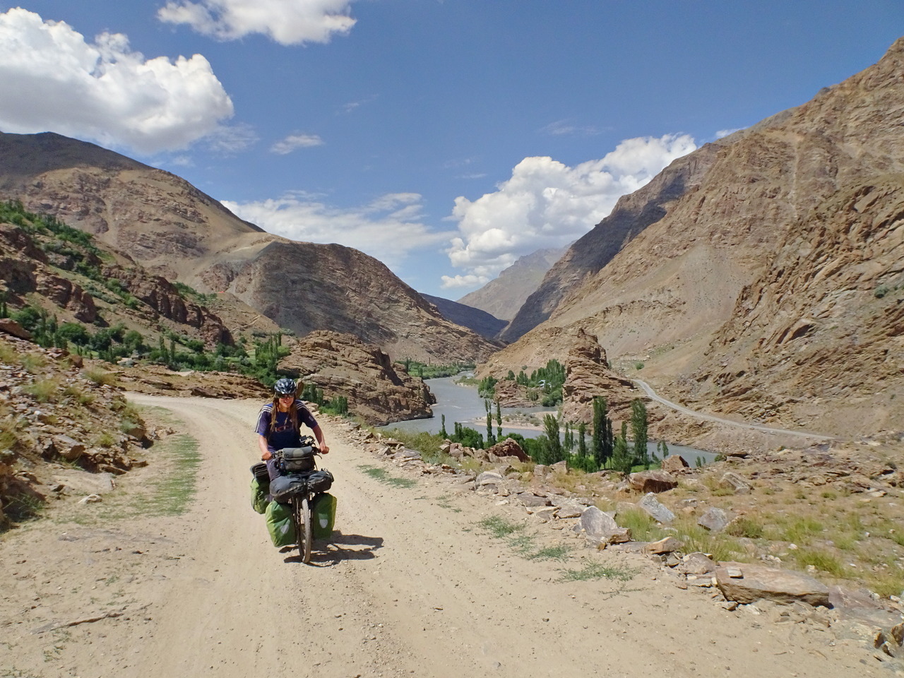
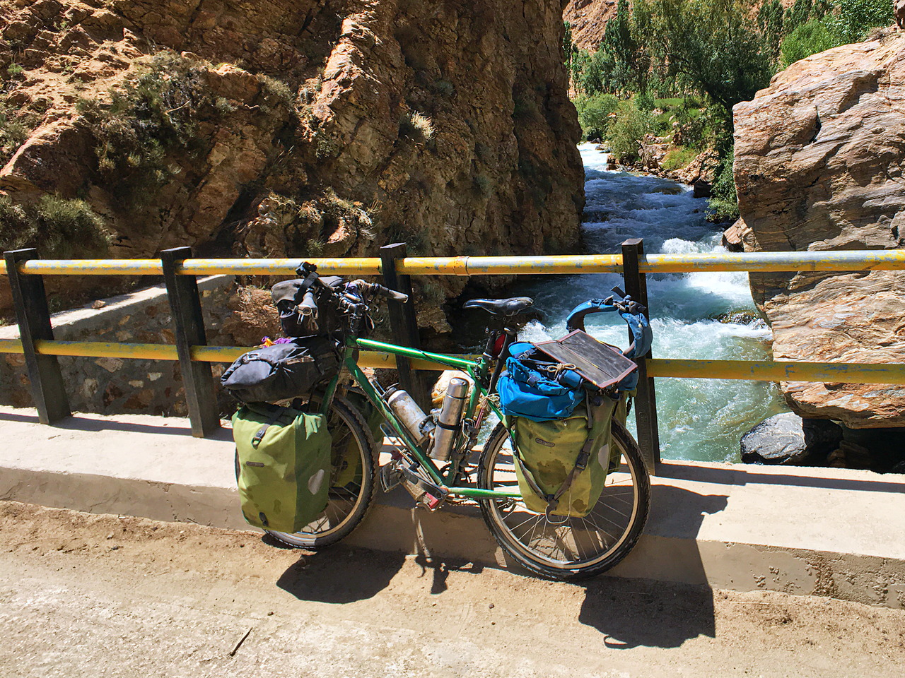
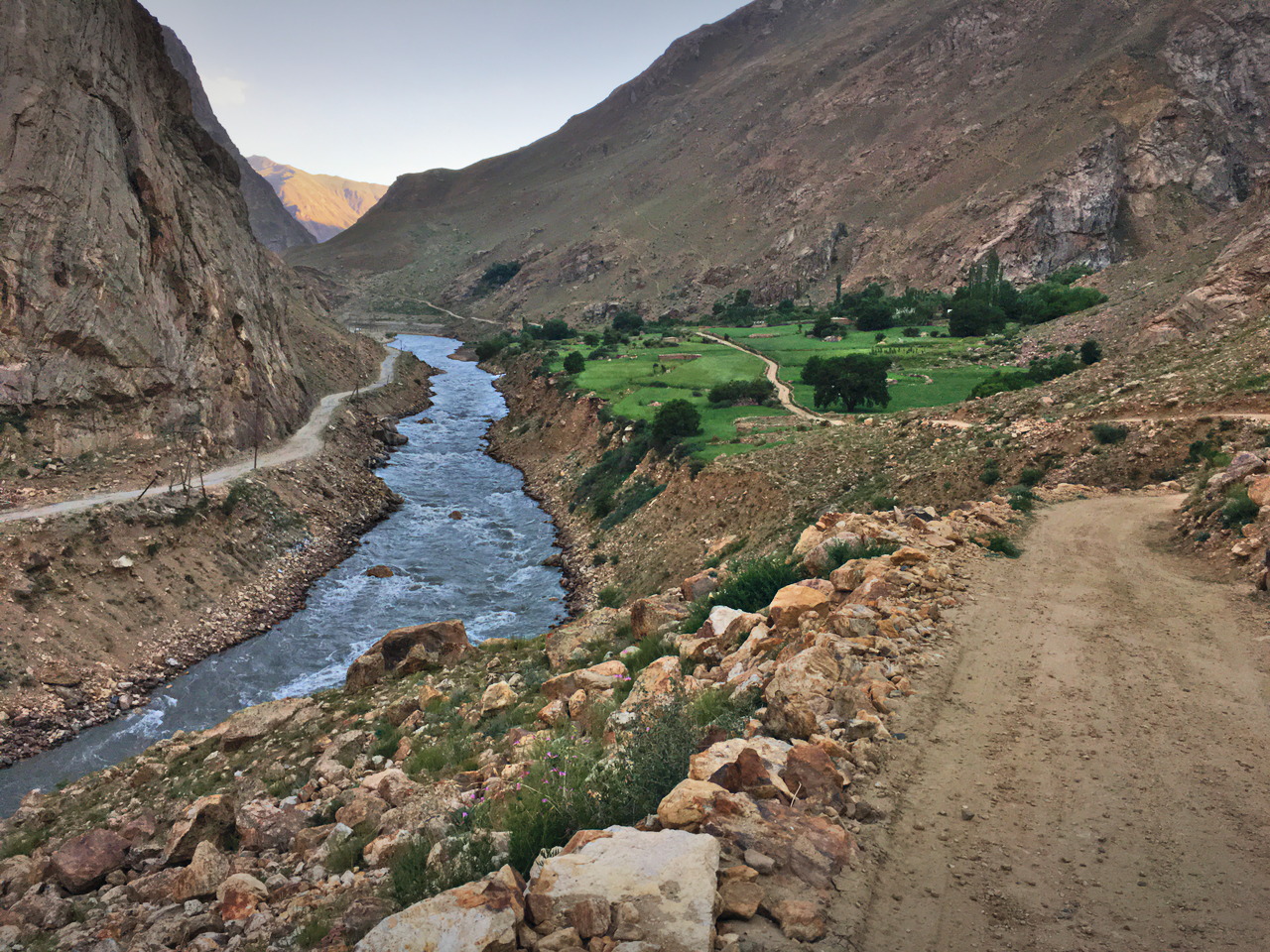
We enjoyed this first stretch in Afghanistan a lot. Although it was relatively hard for us to cycle there – the weight of my bicycle was around 80 kilograms and the dirt road was often very steep – the views over the Panj River were beautiful and the hospitality of the locals was incredible.
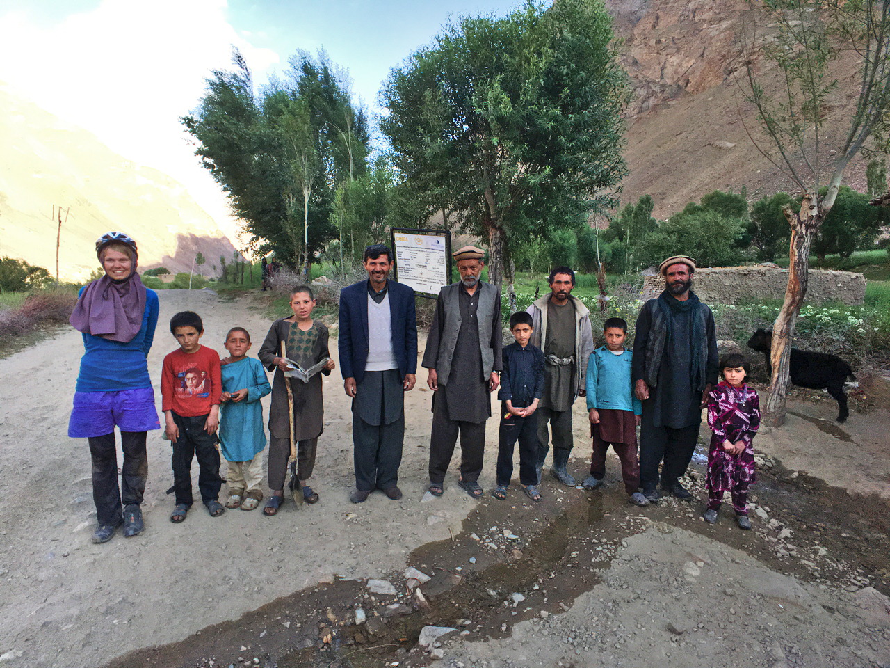
When we cycled through the village of Barnasir, the locals gave us a very friendly greeting and asked us if we have a camera. When I said “yes”, we were asked to take a picture with them. For Grete and me, it was very interesting to see the local life in the small villages that we passed. We saw a lot of donkeys, cows and sheep in the fields and a lot of traditionally dressed people.
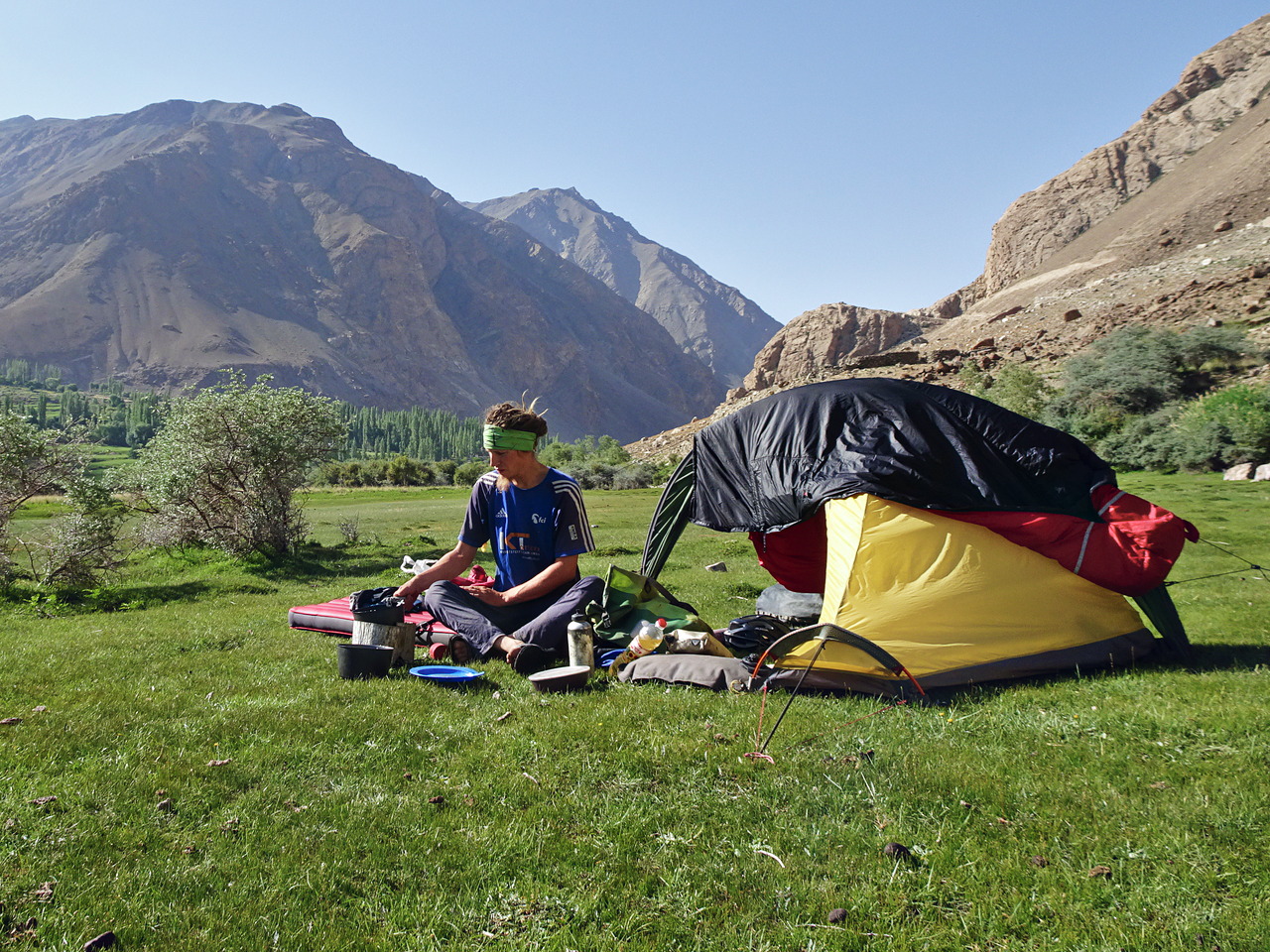
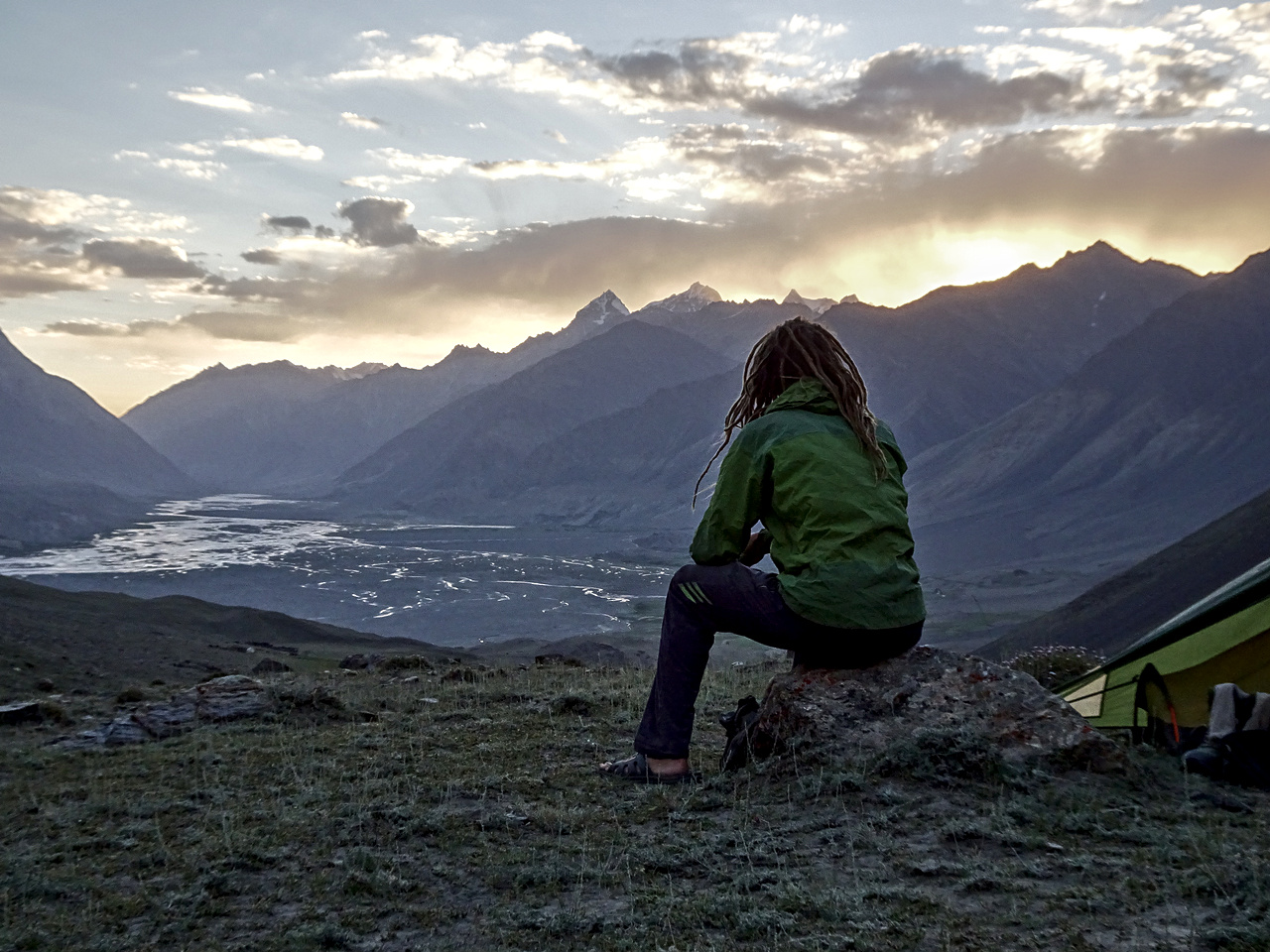
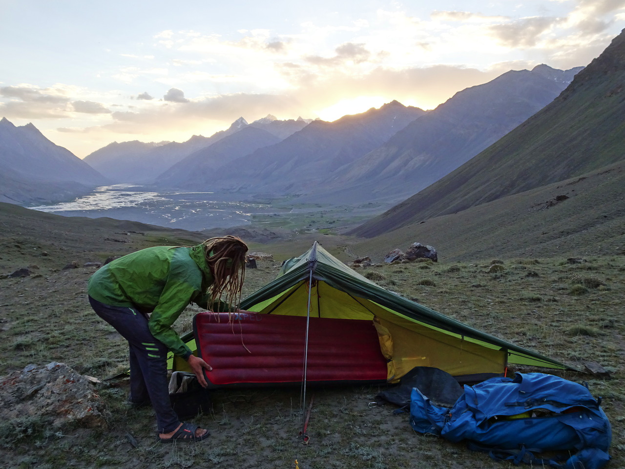
For our second night in Afghanistan, we found a nice grassy field where we could pitch our tents. When we cooked dinner, a car stopped at the road and four men approached our campsite. The men were from the Afghan Border Police and when they realized that we were just travellers and that we have everything we need, they left and we could stay there. As there is not much light pollution in this area, we could see the Milky Way and a lot of other stars before we went to bed.
Between Shughnan and Ishkashim, we had to pass four different checkpoints. Usually, we had to show our passports – but once, the officers weren’t interested in our documents at all and offered us lunch instead.
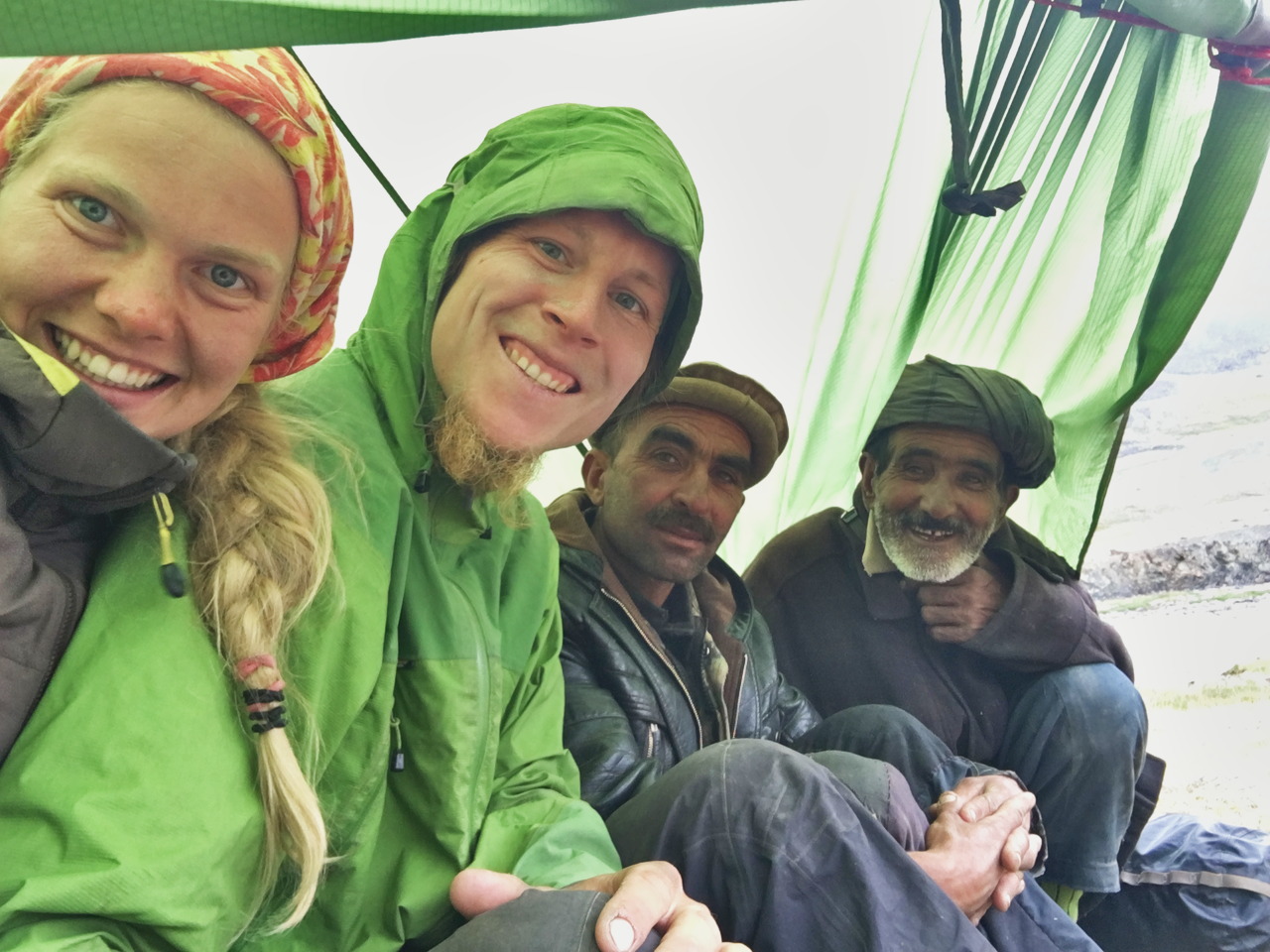
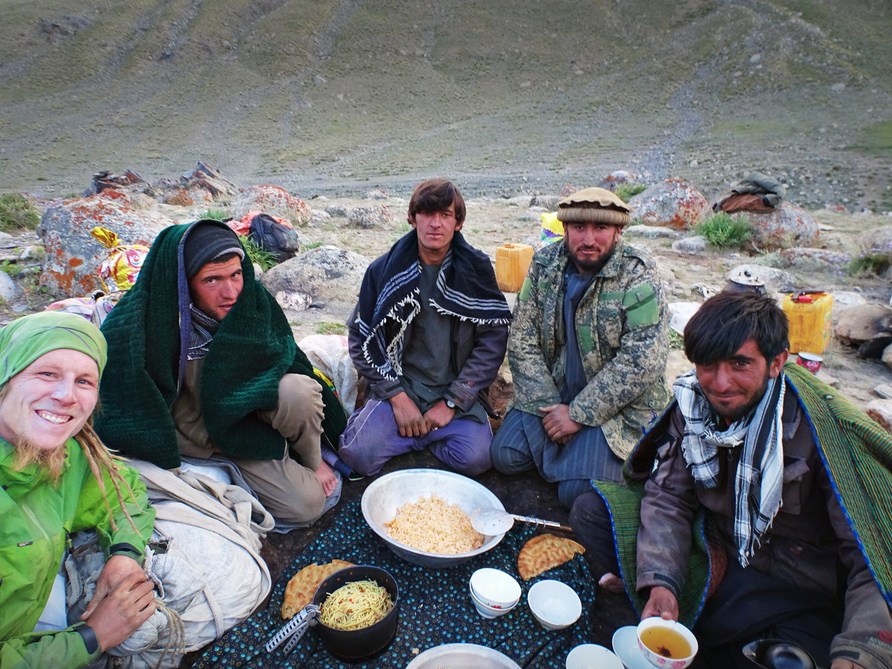
On Wednesday, we met two local men on the road. We stopped a few metres later, as I wanted to take a picture of the scenery. The locals approached and asked me if I would like to take a picture together with them. Obviously, I agreed and gave my phone to Grete to take a picture.
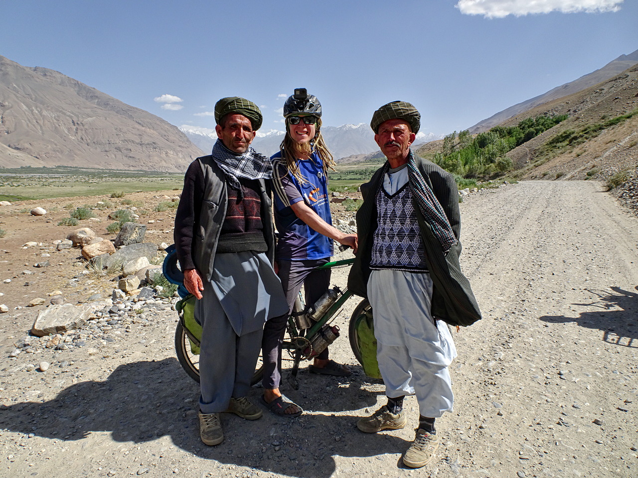
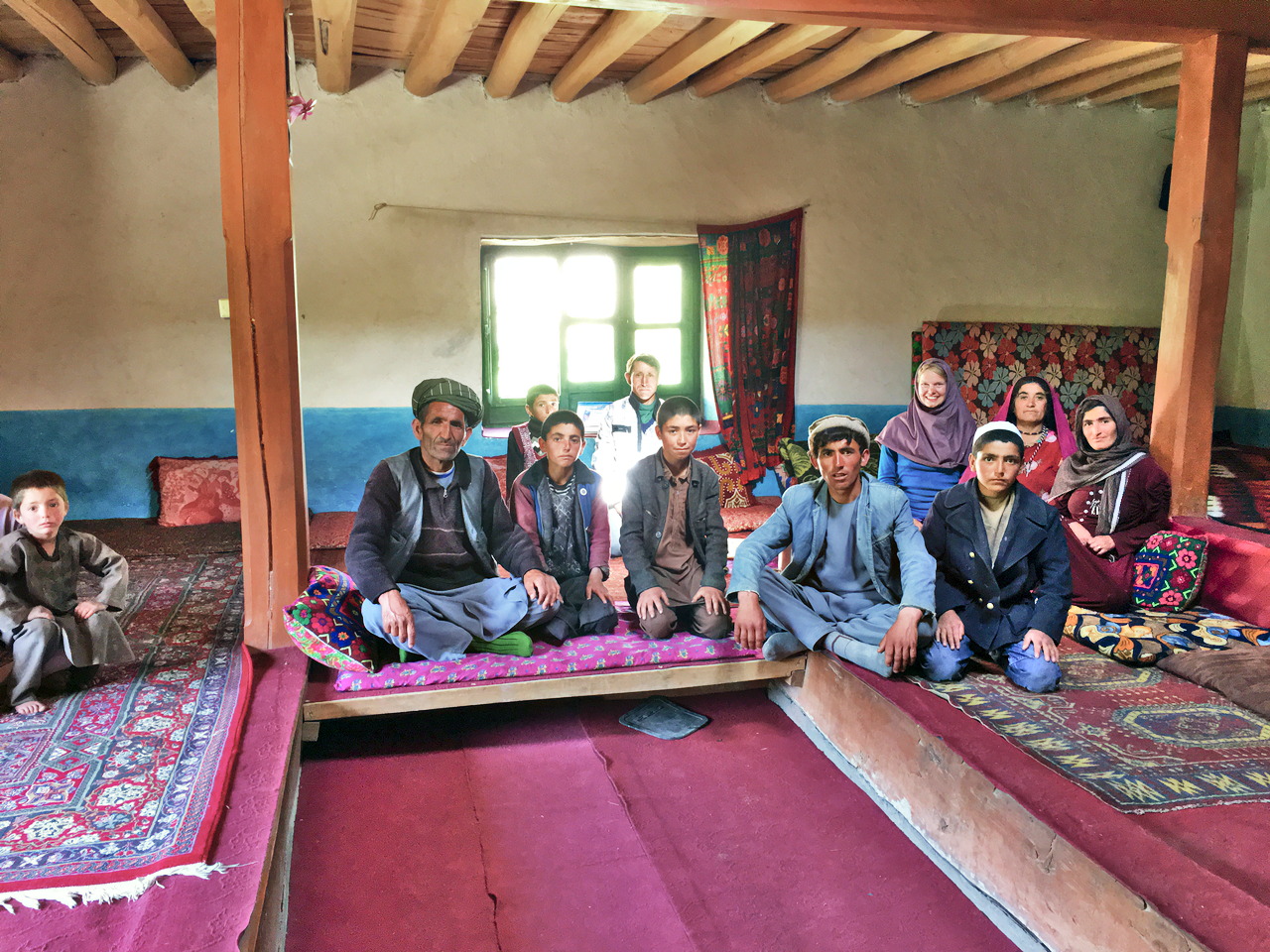
But simply taking pictures together wasn’t enough – the man on my right (left side on the picture) invited us into his house for chai (tea). We pushed our bicycles a few minutes to his village, where he showed us the way to his house. The property was huge and the room where he brought us looked very beautiful. Our host offered us chai and bread and we even could have eaten lunch – but the food he offered wasn’t vegan, thus we gratefully rejected this offer. The longer we stayed inside his house, the more people from his family and his village came round to see us.
The friendly family even offered us to stay in their home for the night. But we prefered to continue to get closer to the town of Ishkashim, where we wanted to organize our permit the next morning. We were very close to Ishkashim in the evening and we tried to find a camping spot – but before we could start searching for a place we were invited by a young woman to sleep in her family’s home.
On Thursday morning, Grete and I went into Ishkashim and we were able to organize the required permit for the Wakhan Corridor. In the town, we also realized that cars – and therefore cyclists as well – are supposed to drive on the right-hand side of the road in Afghanistan. From Ishkashim, we wanted to cycle another 200 kilometres to the village of Sarhad, where the road ends.
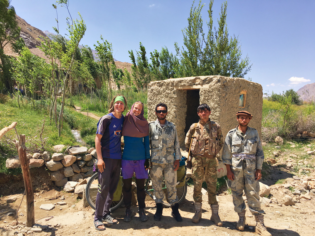
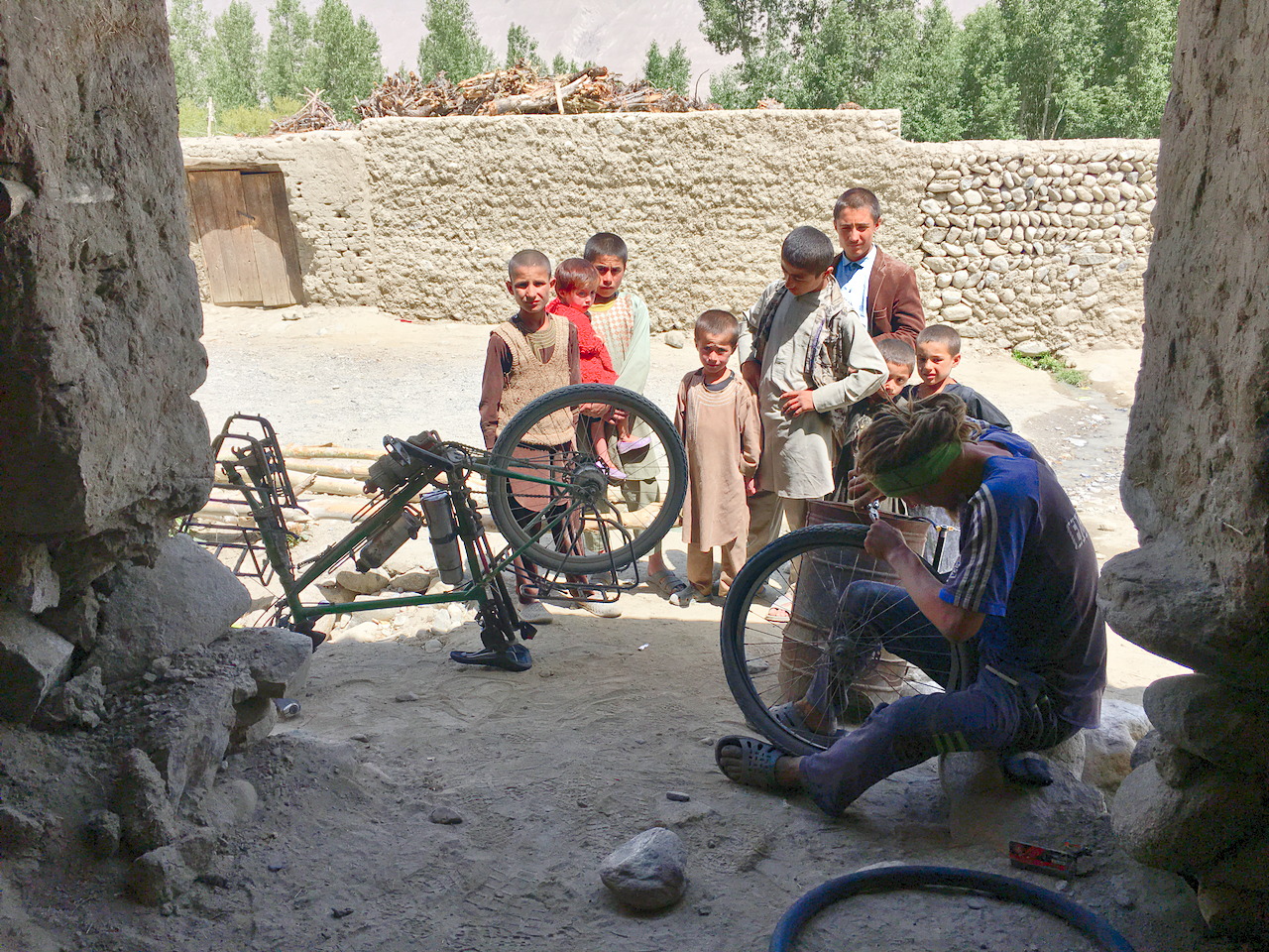
In the town of Khandud, the capital of the Wakhan District, we were stopped by a man and he told us that we needed to register ourselves. He brought us to a building where we had to hand our passports to some officials. A few minutes later, we obtained some papers, which we would need later to pass checkpoints on the road. After that, we had to go to the office of the governor of the Wakhan District. He offered us chai and he read about Switzerland and Estonia on an app on his phone. When we went back to our bicycles, which we had left behind on the main road, my front tire was completely flat, so I had to fix the tube in the village in front of some local kids.
In the office of the governor, we were told to bring one of the papers to the “National Security Police” nearby. Unfortunately, Grete and I weren’t able to find this building. We asked some Afghans, who were driving in their car, where we could find the building of the “National Security Police”. They told us that we just have to continue on the main road. A few kilometres later, we arrived at a relatively big checkpoint. As we couldn’t tell the difference between all the papers we had gotten, we showed all these documents to the officers. Unfortunately, they told us that we missed the building. We didn’t want to push our bikes back on the sandy road, especially as we just had come downhill. One officer invited us for lunch inside the checkpoint and while we were eating, he called to the “National Security Police” and we finally got permission to hand over the document for the “National Security Police” at the big checkpoint.
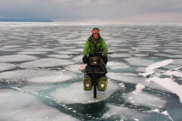
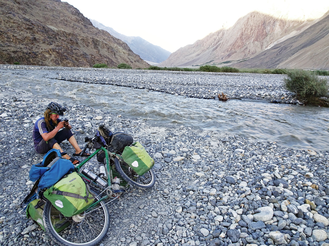
The next few days weren’t much fun for Grete and me, as we both felt weak because we had diarrhoea. We made very slow progress and in the late afternoon of our 8th day, a relatively fast flowing river blocked our way. We met some locals and they told us that on the 30 kilometres long way to Sarhad, there were four big rivers to cross. They also told us that it is impossible to cross by bicycle. But because I could see some locals driving old minibusses through the river, I was sure that we could push the bicycles through the water as well. Grete and I decided to sleep close to the river to try to cross the river in the early morning. Unfortunately, the water was still high in the morning. I tried to push my fully loaded bicycle through the river but after a few seconds, I realized that it would be too difficult and too dangerous to cross like that. Luckily, I managed to get back to the river shore.
Grete and I decided to start hiking from there, leaving our bikes with the locals who are living next to the river. After packing our equipment and food for two weeks in our backpacks, we could continue our trip – by wading through the ice-cold and sometimes waist-high river. After the crossing, we walked along the road. When we were walking on the road, both of us had got several blisters on our feet. Even worse, my left knee started to hurt very much after the fourth river crossing, probably because I hadn’t walked much at all for four months and especially not with a nearly 30 kilograms heavy backpack. When we arrived in Sarhad, I could barely walk properly anymore. Especially when I bent my knee I felt a piercing pain. Luckily, there is a public hot spring in the village. I put my leg under the hot water for 30 minutes. After that, I was able to bend my leg again without feeling any pain. We continued hiking, but unfortunately, the pain returned later in the day.
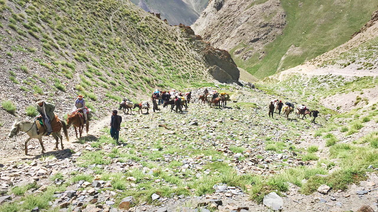
The next morning, I didn’t feel any pain anymore and we started hiking highly motivated because we knew that we would cross the more than 4000 metres high Dalriz Pass. On the way up, we met a big group from the Afghan Wildlife Conservation Society. The group was using around twenty horses and donkeys to transport people and their equipment. We knew one man who was sitting on one of these horses: it was the governor from Khandud who we had met a few days earlier.
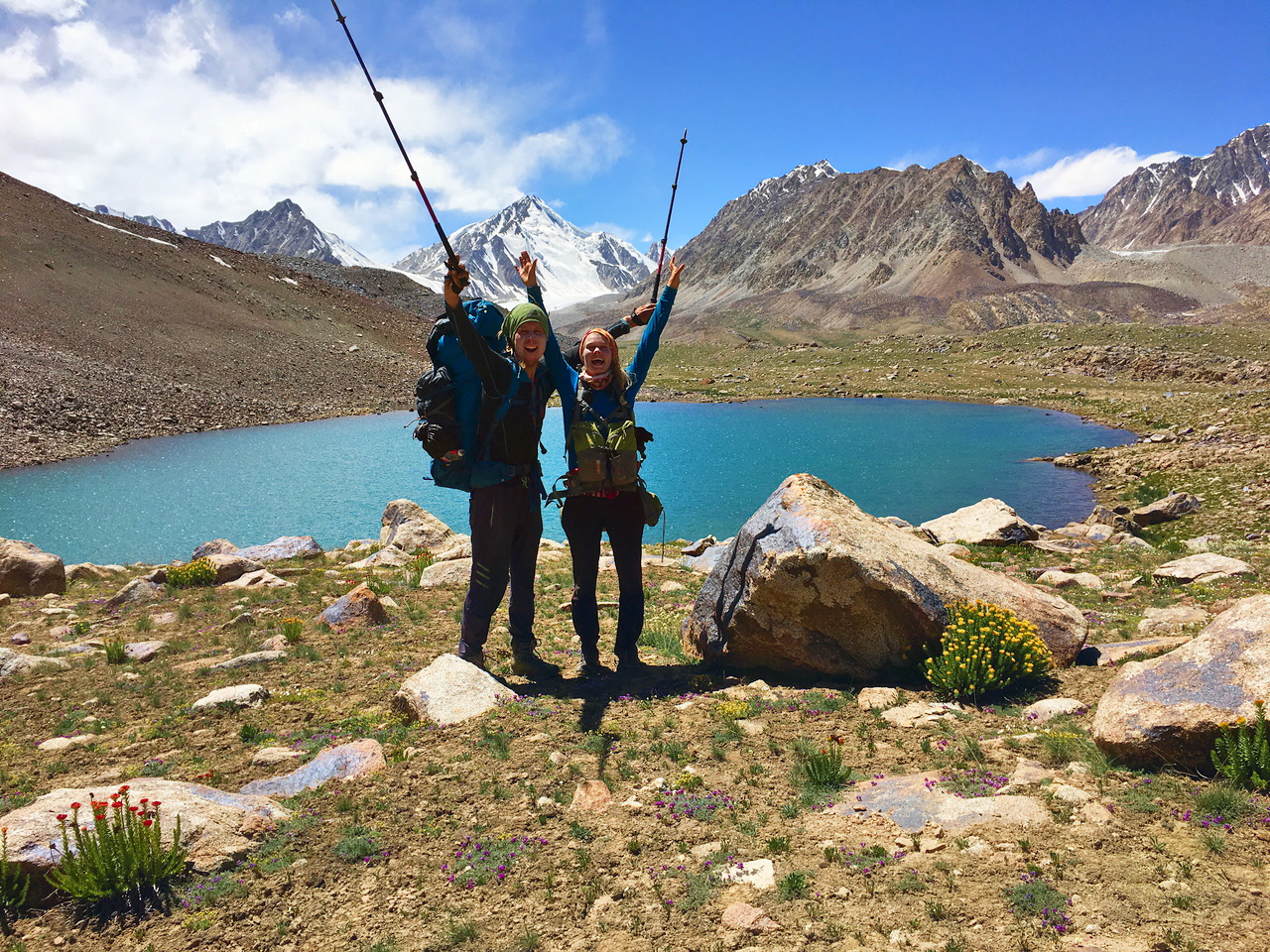
Grete was suffering because her backpack was totally overloaded which caused blisters on her hips. Moreover, she had sunburnt her neck the day before, therefore carrying a heavy backpack was very painful for her. For me, it was not a big deal to walk up to the pass and I would have been much faster than Grete, but when we were walking down my knee started hurting again so that I couldn’t walk properly anymore. Thus on the way down, Grete was much faster than me. I was afraid that this hike could cause some serious harm to my knee which could endanger my upcoming projects. I was even considering turning back to Sarhad, but in the end, we decided to continue slowly along the Wakhan River.
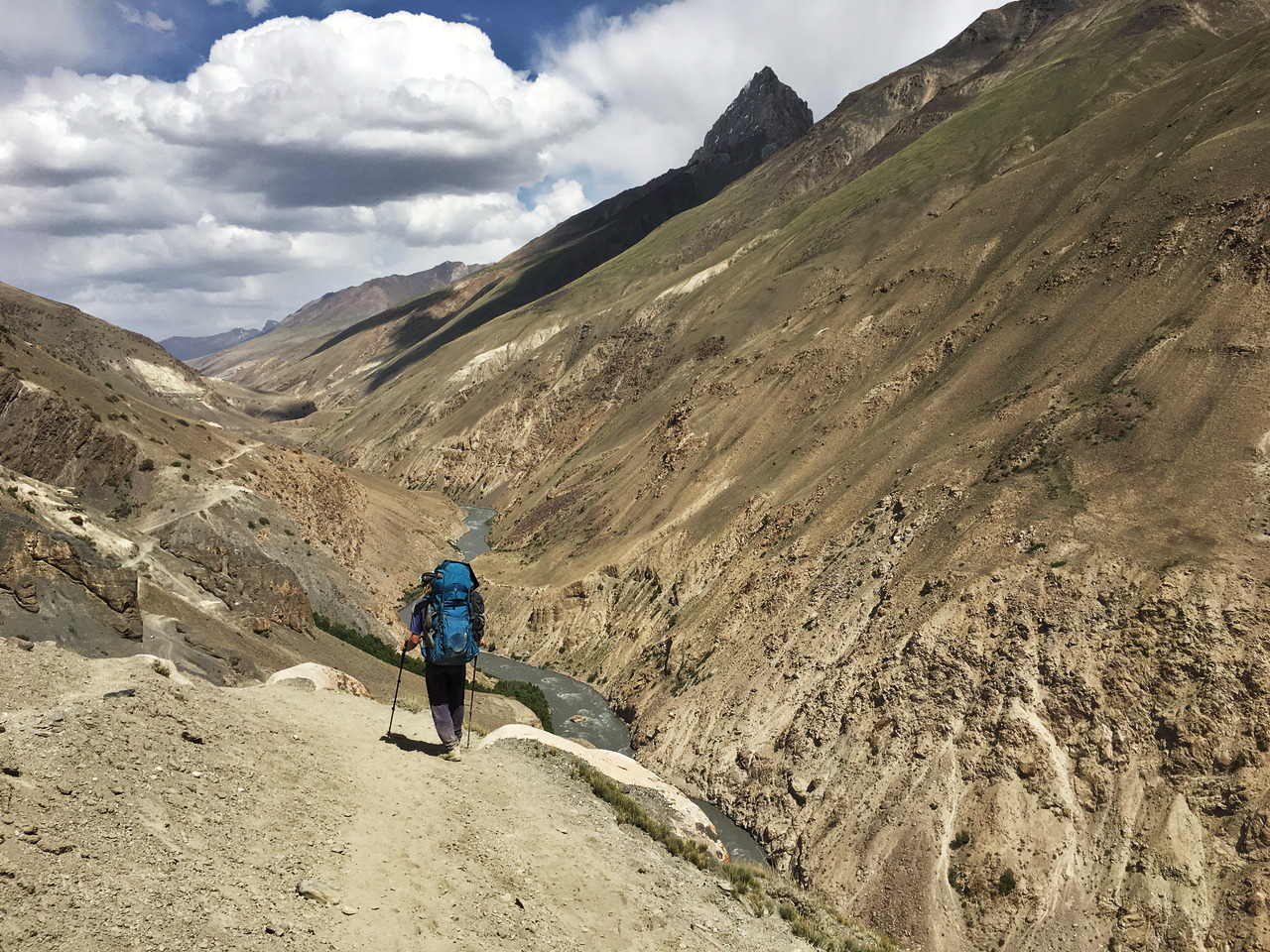
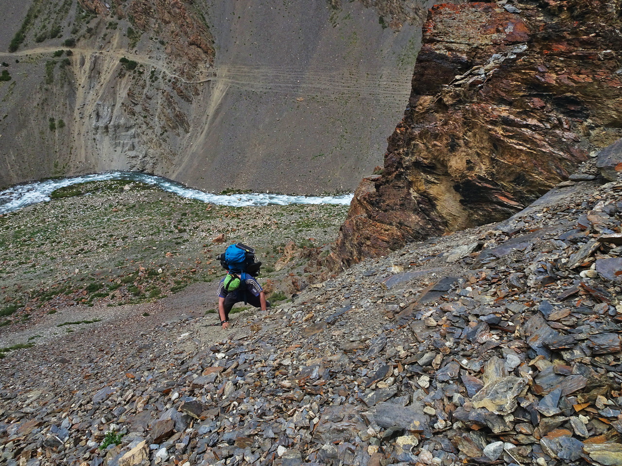
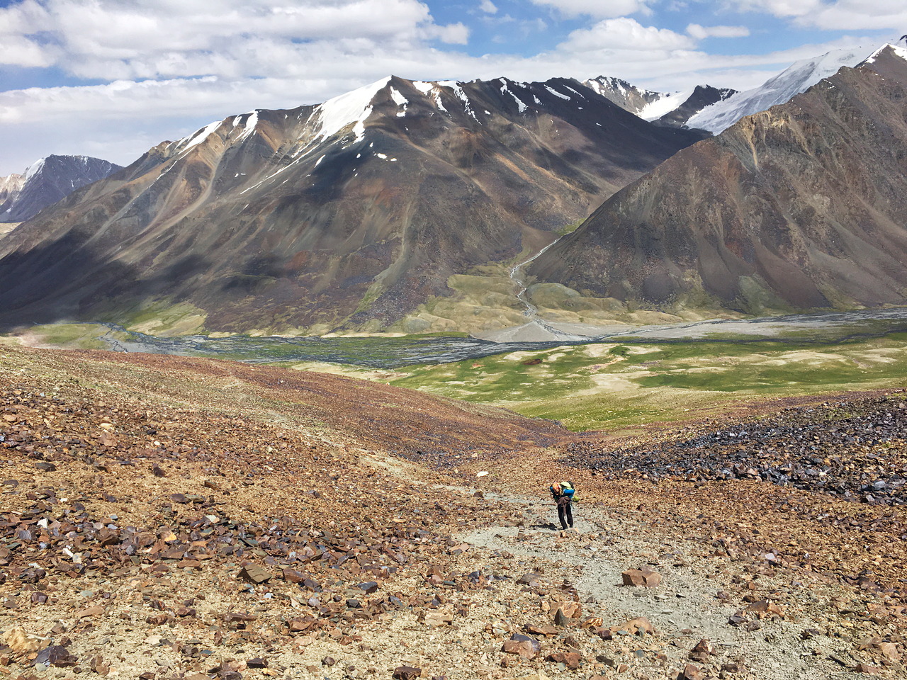
Our initial plan was to hike all the way to the Chaqmatin Lake and even exploring the Wakhjir Valley which leads to China, but due to our slow progress, we had to change our itinerary. As I had downloaded all the satellite images and elevation data from this area to my phone, we could have a look on the map. We decided to neither visit the Chaqmatin Lake nor the Wakhjir Valley and take a shortcut from Langar towards the Garumdee Pass instead. First, we followed a river in the valley, but unfortunately, the relatively wide valley turned soon into a gorge where we couldn’t continue. Instead of walking one hour back, we decided to climb up on the side of the valley to reach a plateau which would allow us to walk around the gorge. The climb didn’t look very steep from the bottom, but it was much harder than expected and looking down was rather scary
We were happy when we arrived at the top from where we could continue hiking. There was even a little path up there. Just before we hit the bigger path which was even shown on my map, it started to rain. As my expensive rain jacket from Haglöfs wasn’t waterproof (actually, it has never been!) and Grete didn’t bring rain trousers, we decided to pitch our tents in the afternoon. Later we wanted to drink a tea in my tent. While I was unpacking the stove, an Afghan shepherd came to our tent. We let him sit inside my tent. He was watching us making the hot drink. When the tea was ready, we offered him a cup. A few minutes later, another man approached our tent. We gave him a cup of tea as well and thus for some time, we were four people inside a 1-Person tent.
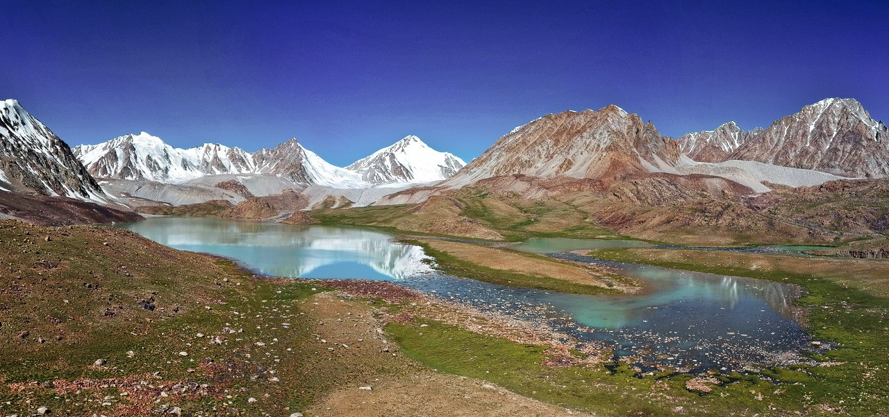
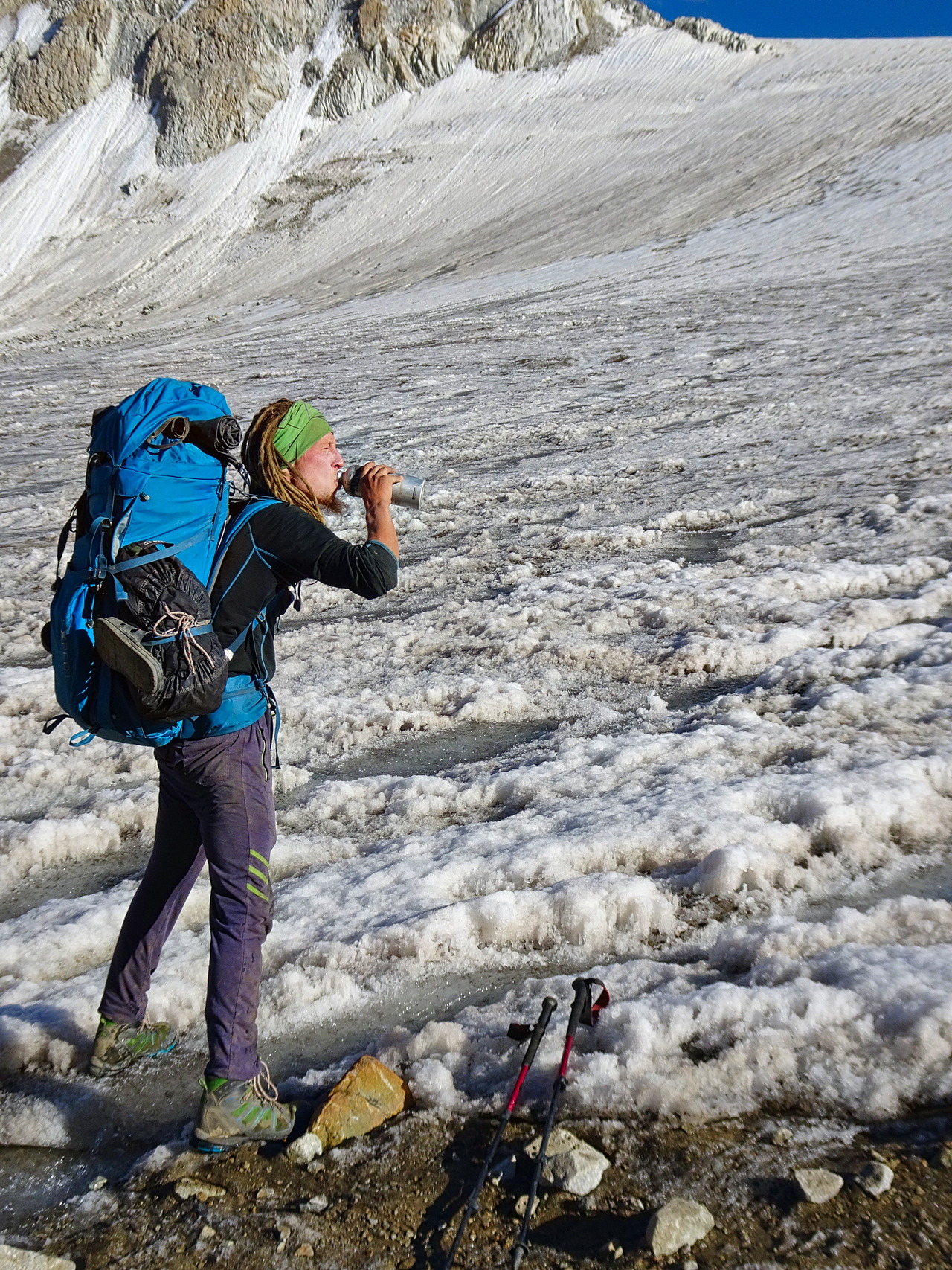
The next morning, our 8th day of hiking, it wasn’t raining anymore. We enjoyed the beautiful scenery while we were hiking over the nearly 4900 metres high Garumdee Pass. We were always drinking water from rivers or streams in Afghanistan and the water from the glacier on top of the Garumdee Pass was very refreshing.
Because my knee hurt again when I walked down from Garumdee Pass, I was very slow and so we had to sleep at an elevation of 4700 metres. The high altitude resulted in Grete not feeling very well the next morning. Fortunately, my knee didn’t hurt anymore and so we could walk down to the next valley. After crossing the more than 4800 metres high Karabel pass one day later, we continued towards some high altitude lakes situated north of Sarhad.
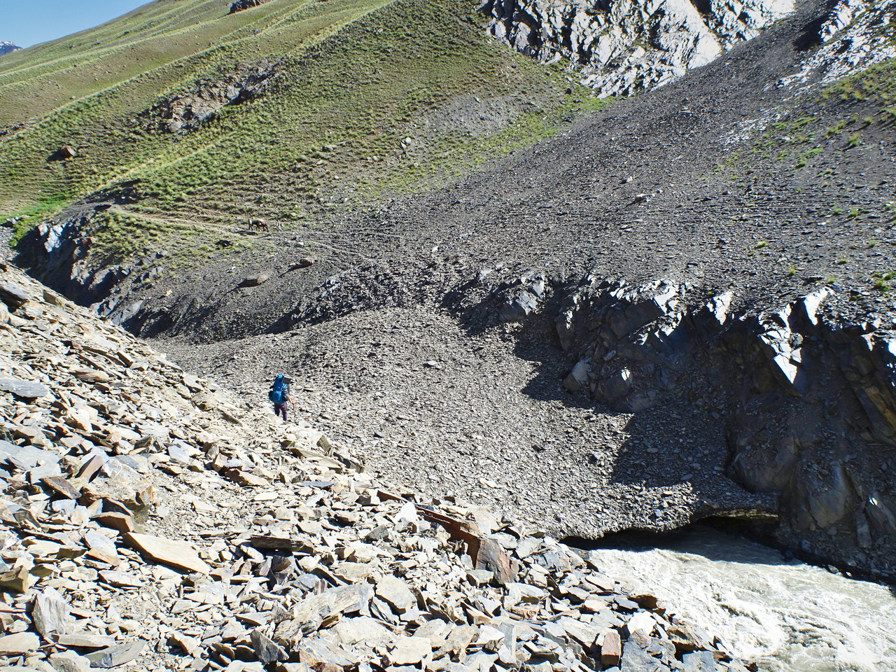
On our way to the lakes, we had to do some tricky river crossings. One day, we already walked down to the shore of an incoming tributary stream to find a spot to cross. Some Afghan shepherds on the other side of the main river waved at us to show us that we needed to walk along the tributary stream. We decided to believe the locals and walked upstream, but the river didn’t look crossable there. We had to walk around a little hill and when we could see the river again it was much wider. We made a break and we were just about to have a closer look at the river when we saw some Afghans on horses. They told us to follow them. We were surprised when we saw the first horses on the other side of the river. Behind the hill, the water was flowing under snow bridge which we could use to cross to the other side.
Although we could cross the tributary stream without getting wet feet, we knew that we needed to cross the main river as well. In the evening, we met some shepherds who were camping next to the main river. They invited us for tea and a young shepherd explained to us that the river was flowing very fast, but he added that the water would be lower in the morning. Grete and I decided to spend the night in the same place. While the Afghans cooked rice, we prepared pasta and then we all shared the food for dinner.
The next day, it was relatively cloudy and windy. As it was already our 12th day of hiking, our backpacks weren’t that heavy anymore and so we managed to reach the high altitude lakes as planned and we pitched our tents there. The night was relatively cold, but we were very lucky that the sky was completely cloud-free the next morning. We started hiking towards a valley leading down to Sarhad. Before we reached this valley, we passed another beautiful lake.
Walking down from a 4700 metres high pass to the 3300 metres high village of Sarhad was very painful for my knee. I was extremely slow and we didn’t manage to walk down in one day. I did not only have problems with my knee but also with the stove. The stove was basically not working properly since the beginning of our adventure in Afghanistan, but at least we still managed somehow to cook our food every morning and evening. We arrived in Sarhad the next day at lunchtime and continued walking towards the place where we had left our bikes behind.
On the way to our bicycles, we had to cross the four big rivers again. We were surprised when we came to the first river, which was the worst one when we went to Sarhad. This time, the water level was much lower and therefore much easier to cross. On 31st July, our 15th day of hiking, we finally arrived back where we had left our bicycles behind. We started unpacking our backpacks, organizing our stuff and packing our panniers. Unfortunately, I couldn’t find my cyclometer anymore. Probably I had lost it 15 days before when we were packing our backpacks.
As we had to leave Afghanistan on 4th August, we wanted to cross back into Tajikistan at Ishkashim which was the nearest border crossing. Although our bikes were approximately 20 kilograms lighter than at the beginning of our excursion, we still had to make relatively long days because we had a strong headwind. We shared the dusty road again with some old cars and donkey-riding people. One day, some cars came from behind and they were driving next to us. The person on the passenger seat lowered the window and we recognized the governor from the Wakhan District, who we had met already two times before.
We arrived back in Ishkashim on 4th August. Grete went to the bazar quickly to buy some delicious apricots. We ate a few and rushed to the border because we didn’t know what time the border would close on a Saturday. Luckily, the border was still open when we arrived there. We got stamped out of Afghanistan and we could enter Tajikistan without difficulties. The following two days, we enjoyed cycling on the paved road back to Khorugh.
Our unsupported trip to the northeast of Afghanistan was an unforgettable experience. We just can hope that one day there will be finally peace in Afghanistan, which would turn this country firstly into a much better place to live for the local people and secondly into an amazing place to travel.